
Satmap Active 12 - Cost including full UK 1:50K mapping £400.00 Current retail price around £450.00

I bought this Satmap Active 12
prior to release as part of the Beta Testing program in November 2013.
Buying Experience
I got the Satmap 12 from
Above and Beyond and found the buying process was good. I have to say however, I was not too happy
about the fact they took payment from my credit card before they got the unit
in stock. In fact I received my credit
card bill with the unit on it well before delivery!
First Impressions
To start with my experience
was not good due to the fact it had to go back twice when the update process
caused a fatal issue with the unit.
Satmap however were quick to deal with the problem.
This incidentally brings me
to the subject of Beta testing. At no
stage was I asked for an opinion about the unit, nor was any form of verbal, or
written feedback requested. In reality
Beta testing for me simply meant buying a GPS with unfinished software on it
and then uploading updates as they became available.
Review based on 1 year of
regular use since November 2013
The first thing I need to
say is I am no GPS expert and I actually enjoy map reading using paper maps and
as such have resisted using GPS mapping software for years. That said I do a lot of mountain walking on
my own, very often in the dark, either when heading up a mountain to catch the
early morning light, or indeed, heading down in the dark after a sunset. I therefore got the Satmap 12 to make life
that little bit easier and to use as a backup for the inevitable navigation
difficulties (ok cock ups) I sometimes experience when navigating in the
mountains at night.
The unit has also been used
for the odd Geocache and for road/mountain biking.
 |
| Hunting down the odd Geocache was a good way to get to know the unit |
In Use
On the whole it is a decent
piece of kit, although there are several niggles.
For example in anything
bordering on wet weather damp easily gets between screen protector and the
screen itself, which obviously affects viewing the unit. Removing the protective screen is not that
easy in the field so you either put up with it, or remove the protector
altogether and then risk scratching the screen. It is not a serious issue as far as reading the mapping goes, but
does mean you have to remove the cover at some stage to ensure the screen has
dried out. The unit of course is only
weather resistant, not waterproof, but even so if the screen cover joint is hit
by a few drops it becomes a problem. It can also be an issue in damp misty
conditions as well. If it bothers you
too much then a separate protective case can be purchased at additional cost.
Another associated problem
is that dust and other debris can easily get between the screen protector and
the screen. This really hacks me off as
I find it distracting in certain light conditions. Would it really have been so difficult and expensive to add a
seal?
The unit comes supplied with a rechargeable battery unit and a separate battery carrier, in which you can add 3AA batteries should the rechargeable battery become discharged. One of the concerns I have with the plugging and unplugging of each battery pack is that the plug is so tiny you end up pulling on the wires rather than the plug. It is also rather fiddly and a complete pain when it is cold and windy. Why a simpler click system, similar to say a camera, or mobile phone was not used I don't know.
Charging/Download cable
This has a 90-degree bend at
the Satmap end of the plug and is of very poor quality and has already
split. I do not incidentally unplug it
by pulling on the cable itself. To deal with this I have simply swapped it for
a cable with a straight plug.
On the subject of charging,
the unit also switches on and goes through the full boot process when you plug
in the charger instead of simply charging the unit. I got caught out the first time when I simply put the unit away
after charging only to find out the battery was flat when I came to use
it.
Having read a number of
magazine reviews, many of which appear to have been written quite soon after
the release, it amazes me that nobody has mentioned some of these niggles. Actually no it doesn't, using something for
a couple of weeks is not really a review is it.
Unit Operation
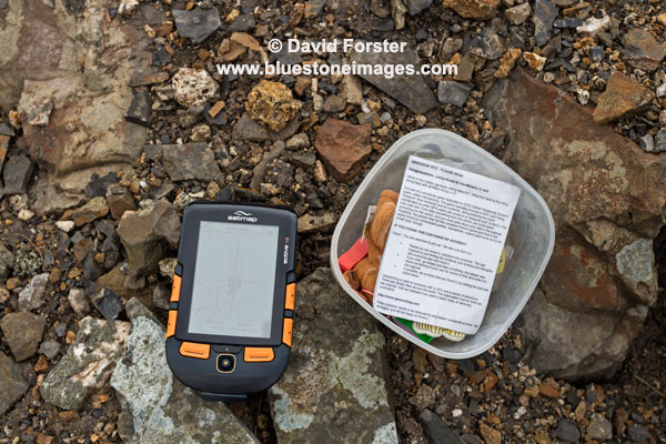
The OS mapping software
comes on SD card which simply clicks into the side of the unit. The clarity of the
High-Resolution HVGA screen is
excellent. A pal of mine has the Active10 and there is a clear improvement
here.
Using the large orange
buttons to navigate the various menus is pretty straight-forward and fairly
intuitive once you understand the terminology.
The unit is also relatively
quick to boot up, load mapping from the card and find satellites (average 2-4 minutes). This does appear to be an improvement when
compared to the Active 10 a friend of mine has.
One slight negative is that
sometimes the software seems to run very slowly for no identifiable reason and
navigating around the map can be frustrating when you move the joystick, but
the map hardly scrolls. Tiling is also
quite bad when this happens. That said
I use this unit week in week out and it has not become a serious issue for
me. I assume this will be resolved in
future software upgrades.
Testing Limitations
I only use a fraction of the
functions available on this unit and therefore cannot comment on such things as
paperless geocaching, detailed route planning, barometric elevation, bluetooth
and peer-to-peer sharing for example.
My experience of the mapping
software is limited to the OS 1:50,000 maps.
I have yet to try updating
the software and as I mentioned earlier I did have some serious issues with the
upgrade process during beta testing and the unit had to go back twice. However this was using a different
"Light" update process to the Satsync process users now go through
and I was assured this would no longer pose a problem.
In Short
Pros
- The high res screen also means I don't have to keep putting reading glasses on to see the detail.
- Orange buttons are easy to see in the dark and fairly easy to use with gloves that are not too bulky
- Software and mapping fairly straight forward to operate
- Additional mapping such as OS 1:25K is available on SD cards
- Rechargeable battery life is good and once discharged it is possible to replace this with 3 AA standard, or Lithium batteries using a separate carrier (supplied with the unit)
- Compass can be calibrated for use on a bike.
Cons
- Relatively high cost of unit
- Additional mapping seems expensive.
- Changing the battery carrier is a pain due to the tiny plug and you end up pulling on the wires.
- Screen protector is poorly designed and allows dust, damp and water between it and the screen.
- Design of the charging/power cable is poor quality and design
- The unit also switches on and goes through the full boot process when charging instead of simply charging the unit.
All said I think this is a
decent unit and the positives certainly outweigh any negatives.
Rating 4 out of 5

Important information for those new to mountain navigation.
Batteries will discharge
quicker in cold weather and you need to carry spares.
If only using the 1:50
mapping software that comes with the unit as standard, a lot of detail such as
steep ground and crags for example will not necessarily be obvious.
Regardless of the mapping
just like a paper map you still need the ability to read map contours,
recognise slope aspect and be able to plan your route, taking into
consideration your speed and the fact you may need to navigate around hazards
rather than walk on straight A to B bearings to reach your objective.
Text/imagery copyright David Forster www.bluestoneimages.com
Text/imagery copyright David Forster www.bluestoneimages.com